Maps
NYC Maps:
 Brooklyn
 Queens
 Staten Island
 Manhattan north
 Bronx
Bronx
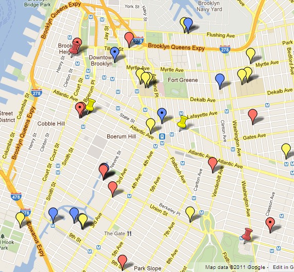
Legend:
 = Regular shows.
 = Irregular shows.
 = Infrequent shows.
Most NY galleries are located in areas that are easy to navigate. The heart of Chelsea, for example, is a simple zigzag between 10th and 11th, from w19 to w27. Most of the time is spent in galleries. Just print out (or scroll down through) a chunk of the List, and boom, you can cover the area pretty effectively.
Other areas are more of a challenge. The average Brooklyn gallery, for example, is as good as the average one in Manhattan. And more varied, so worth the effort. But with a few exceptions (Dumbo, 56 Bogart), they are spread out from hell to breakfast. Most of the time is spent in transit. Avoiding frustrating backtracking is important. Irregular hours from gallery to gallery compounds the challenge.

Accordingly, these maps were created to strategize visits in the lower density areas. Simply print a chunk of a map area to visit, confirm on websites which ones are (probably) open, then develop a plan to get from one to the other. Trains & buses can be essential mid-stride, eg the B61 in Red Hook. And a focus on more than just the art helps — eg the exercise, the hopefully nice weather, or the dramatic changes that are ongoing in most of the gallery nabes.
{Ideally, this entire site would be graphics-based. A map of the city would be the main webpage. Pins could identify all ~1300 art galleries, museums and other show locations. Or all shows currently up (the default). Or all shows that have had critical notice. Or all shows open right now (eg when opening the website on a Sunday afternoon). Or all the shows that are in their final week. Or their final day. Or all shows that haven’t already been viewed (clicking “seen” would be an option). Or all the shows that have been prioritized (clicking “must see” would be an option). Etc.}